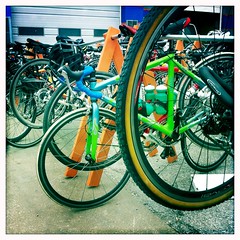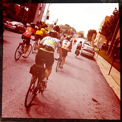
On Sunday, May 22, some friends and I participated in Kansas City’s Tour de Brew 30-mile ride. This is my second organized ride and my longest consecutive ride by 10-miles. View route GPS.

The ride started and finished at Knuckleheads Saloon, in the Northeast Industrial District of Kansas City. Knuckleheads is definitely unique. It lives up to the images one would conjure up thinking about a saloon in the 1940’s.
We started off on the 30-mile ride at 9:00 am and returned just after 12:30 pm. We looped through downtown, the Crossroads District, midtown and the Plaza, before making our first stop for a mini-gelato at SPIN! Pizza. We refilled quickly and were on our way south through some beautiful Plaza and Brookside neighborhoods. We rode on to Family Bicycles at 74th and Wornall where we made another pit stop, before turning around to finish the route back.

Seasoned cyclists are a courteous bunch. It’s common for someone to yell out, “car back,” when they notice a car approaching from behind. When approaching a stop sign, they yell “clear right, clear left,” to signal nearby cyclists it’s safe to proceed through the intersection.
I enjoyed getting to see parts of the city that I wouldn’t have otherwise explored. Cycling is an experience like no other, you get a feel for neighborhoods, people, places, and best of all fresh air. Next time you’re thinking of buying a home, bike the neighborhood for a more intimate perspective of the people, places, and things.
Other riders blog about 2011 Kansas City Tour de Brew
- First Annual Tour de Brew – thedirtieduckie.com
- 2011 Tour de Brew Photos – Aaron Dougherty Photography
There is a cool feature at MapMyRide which will create a couple minute “flyover” of any route in MapMyRide using something like Google Earth or Streetview video. I’ve drawn the 32 Mile Tour de Brew route. Check it out if so inclined.
Thanks. I’ll check it out. Can I draw the route using the .kml file from Cyclemeter or do I have to use MapMyRide to map the ride to begin with?
Depending on what type of phone you have, you can also use the GPS on the phone with the MapMyRide app. I found it helpful if you take a lot of back roads and turns like the Tour De Brew.